
Kennett - General History
The parish of Kennett, c. 4 km. (2½ miles) north-east of Newmarket (Suff.) and c. 8 km. (4 miles) north-west of Bury St. Edmunds (Suff.), covering 560 ha. (1,431 a.), lies in a projection of the county that stretches eastwards into Suffolk. The name Kennett is of Celtic origin, and has been associated with kun-, or cwm-, top or summit. Early spellings vary, but from c. 1604 Kennett has been the commonest. The modern southern settlement is called Kennet End.
The northern, southern, and western parish boundaries are at right angles to each other. The irregular course of the river Kennett forms the southern end of the parish's eastern boundary before running northwards through its northeastern section. There are alluvium and river terrace deposits on the river's north-east and south-west banks, and glacial silt and gravels, eventually worked-out, underlie its central loop. A ford crossed the Kennett c. 1161, and in the late 13th century a ferry crossing was known as Kentfayre. The river was navigable at least until the early 14th century, connecting the parish to the fenland waterways, and on to King's Lynn (Norf.). Occasional overflows from the river caused serious damage to property in the eastern section of the parish, destroying the railway bridge in 1968, but in 1977 a pumping station was built at the northern end of the central loop to control the water flow. In 1995 the river had ceased to flow. A tributary of the river Snail rises 600 m. east of the middle of the western parish boundary, and then flows northwards. In the centre of the parish there is an elevated plateau (30 m. high), with Dane hill at its north-western tip. The ground then falls away to the north and south before rising at the southern edge of the parish to 30 m. The topsoil of chalk, clay, and gravel overlies Lower Chalk, which runs from north-west to south-east. In the 1790s gravel beds yielded high quality marl.
A bridge stood at the south-east corner of the parish from 1604 or earlier, linking Kennet End and Kentford (Suff.), and was known as the old bridge in 1797. It was crossed by the main Newmarket-Bury St. Edmunds road. That was a major route during the 17th century, and a turnpike during the late 18th and 19th centuries. In the mid 12th century the road which ran north-eastwards through the north-west corner of the parish, along the route of the ancient Brandon way, was known as the Freckenham road, but since c. 1797 as the Norwich road. Tree-lined since 1820, it was widened in 1929. It was crossed by the Chippenham Road, recorded in 1161. In the early 19th century, and probably before, the Chippenham Road divided into two roads, running eastwards towards the village. The northern route ran over the heathland, but was closed off at inclosure in 1823. The southern road, on the boundary between the heath and South field, met other roads, running north-eastwards to Herringswell (Suff.), and southwards to Moulton (Suff.), at a triangular junction south of the village. From c. 1820 the Moulton road was named Kennet End road, and from c. 1854 Station Road.
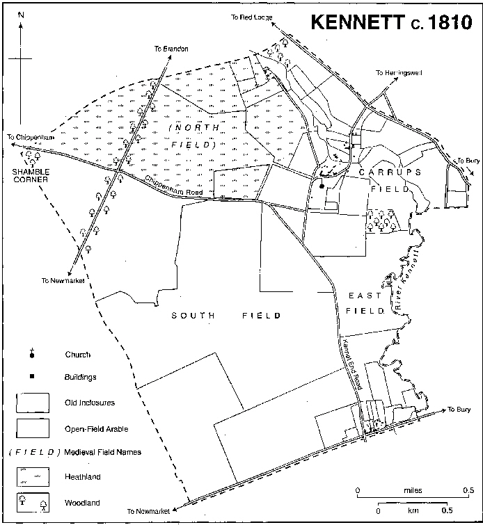
Kennett Present Day ( showing the parish Boundary) Kennett at c.1840 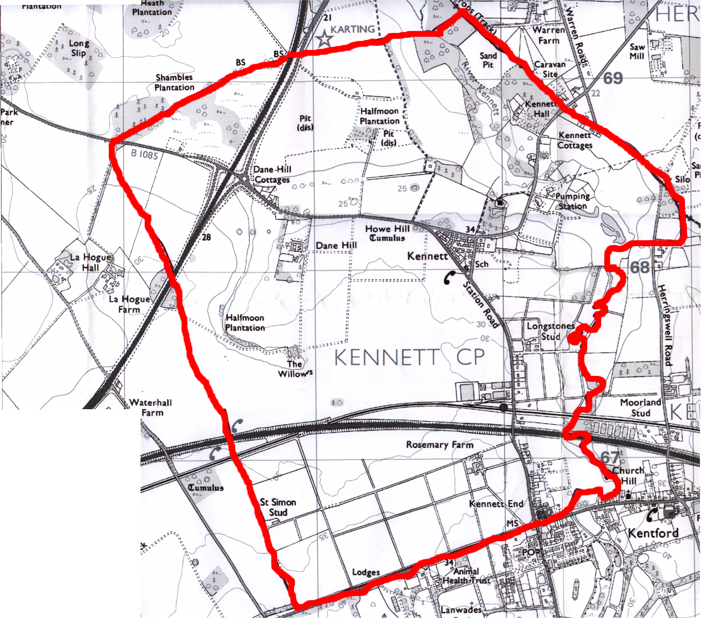
The Newmarket to Bury St. Edmunds railway line, existing in 1854, runs south-eastwards in a cutting through the south of the parish; Kennett railway station was built midway between Kennett village and Kennet End on Station Road. The station also served neighbouring parishes during the 19th and 20th centuries, with a staff of four including a station master between c. 1861 and 1891. From 1965 it was closed to goods traffic, and after 1967 it became an unstaffed halt on the Cambridge-Ipswich line. The Newmarket bypass, built c. 1972-5, runs parallel with the railway line, the two separating the northern part of the parish from Kennet End. Between 1989 and 1998 there was only one bus service daily from Kennett village, but there were better bus services from neighbouring Kentford (Suff.). One in five households in Kennett had no car in 1991, double the proportion in neighbouring parishes.
In 1086 Kennett was inhabited by 19 peasants. By 1279 it included 30 landholders; in 1327 there were 27 tax-payers at Kennett and Badlingham; and in 1377 the poll tax was paid by 48 adults in Kennett and Kentford. There were 17 dwellings in 1664 in Kennett and Badlingham. Kennett's inhabitants numbered 90 in the early 1790s, 111 in 1801, 164 in 1821, and 208 in 1851. During the 1850s and 1860s the population declined, but c. 1871-81 was stable at c. 159-65. It had increased to 182 in 1911, and remained at 200 between 1931 and 1951, and from 1961 to 1991 at c. 270.
During the Middle Ages Kennett village developed to the north of the parish church along the Herringswell Road, across the valley of the river Kennett, sheltered by the north-east face of the central plateau. Between 1664 and 1674, apart from the manor house and a farmhouse, probably at Dane hill, no dwellings had more than five hearths, and a third of them had either one or two. There were 15 houses in the parish in the early 1790s. In 1821 houses stood at the corner of the Chippenham and Kennet End roads south-east of the triangular junction, and in 1841 there were 25 households at Kennett village. In 1849 a new bridge, with abutments and wing walls and an iron-girder superstructure, was completed over the river in the heart of the village. Between 1865 and 1873 the southern section of the village street was diverted eastwards, slightly further away from the church, on the orders of the principal landowner. A council housing estate was built c. 1958-62 in the triangular junction to the south of the village. In the mid 1980s those houses were purchased by tenants, or taken over by the Hereward Housing Association. In 1989 there were 48 houses in the triangle, which formed the new centre of the village, another ten houses standing along the village street and Church Lane. The barn of Hall farmhouse at the northern end of the village street was converted in 1986 into a large and opulent house. Ten new detached houses were built in 1997-8 at the north-east corner of the triangle.
From the late 16th century there has been a farmhouse at Dane hill, 0.5 km. west of the village, on the south-side of the Chippenham Road. It is a timber-framed L-plan building with an attic and a plain tiled roof, and may have had six hearths in 1664 and 1666. An adjoining 17th-century one-storeyed cottage-gatehouse with an attic was also occupied in 1998. During the 19th century there were six cottages nearby, but in 1903 only three. In the late 20th century the cottages were modernized, and the farmhouse was split into two dwellings.
In 1797 at Kennet End there were houses at Market row along the northern side of the Bury St. Edmunds-Newmarket turnpike. In 1823 there were 14 dwellings, which each had c. 1 a., held as freehold, stretching back from the Bury turnpike. There was further development northwards along Station Road, with seven pairs of cottages c. 1861, and a further 20 by 1925. Kennet End was significantly larger than Kennett village during the late 19th and early 20th centuries, and in 1997 there were c. 40 houses there. In 1990 after much effective campaigning by Kennett's inhabitants the county council rejected plans for an additional 1,500 houses in the parish. In 1991 there were 130 dwellings, comprising 55 detached houses, 55 semi-detached houses, and 10 other types of dwelling.
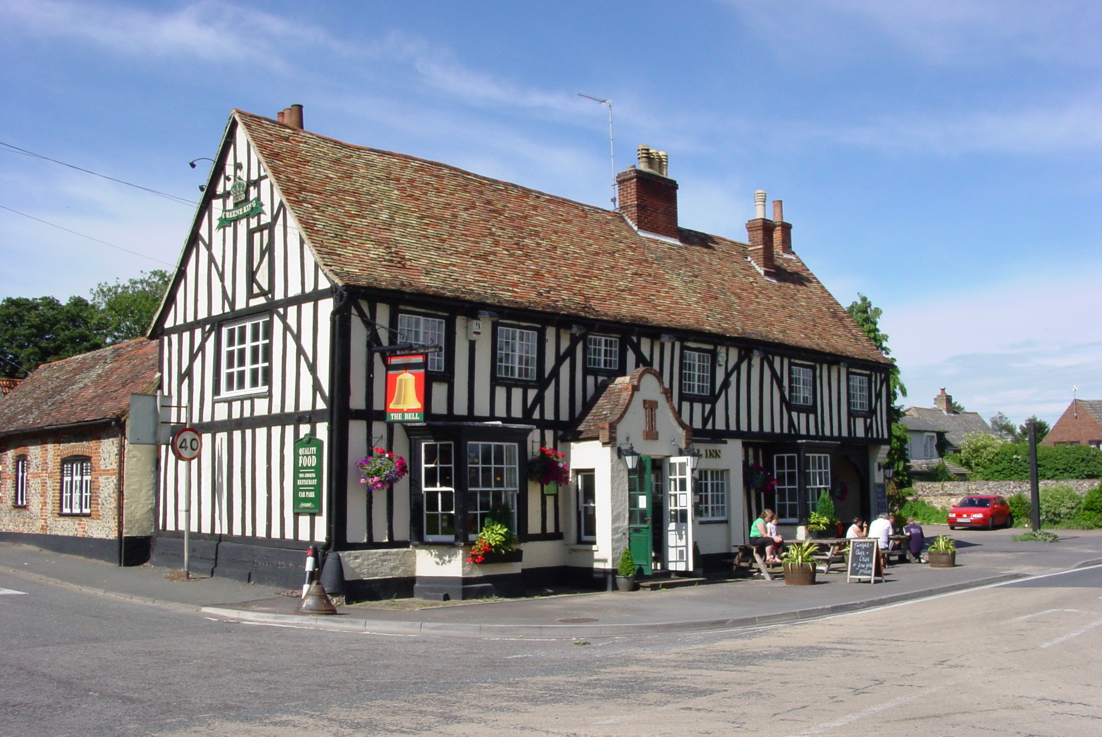
The Bell Inn on the crossroads at Kennet End dates from the 16th century. In 1737 Edmund Bowle of Pakenham (Suff.) sold the public house and 21 a. of land to Thomas Evans, and in 1785 it provided a change of horses for travellers. It remained in the hands of members of the Skulthorpe family from 1783 to 1854, and from 1818 until the late 1990s it provided accommodation for travellers.
The Bell Inn
During the 20th century Kennett's inhabitants relied for some social activities upon Kentford, belonging to its Women's Institute or British Legion branches. In 1951 Donald MacLaren gave 2 a. east of Station Road to Kentford and Kennett sports club for use as playing fields. In 1997-8 there was an unresolved debate over whether to build a new village hall on that site, or in Kentford.
The heathland in the north-western corner of the parish was quarried extensively during the early 20th century, and was then used as a waste tip by local racing stables. From the early 1980s scramble-bikers rode there, but in 1991 the 60-a. site was purchased by Wildtracks Ltd. The company offered a range of off-road activities, and was said to own the largest collection of privately owned military vehicles in the country. In the late 1970s Suffolk county council deposited 250,000 tonnes of waste in the adjacent area east of the Norwich road. In 1996-8 the council wished to use the site to pile up a waste disposal mound, 38 m. high, occupying 82 ha. (202 a.), but the plan was opposed by Kennett's inhabitants.
MANOR AND OTHER ESTATES.
The manor of KENNETT held by Toki the thegn T.R.E. passed to William de Warenne, later earl of Surrey, T.R.W. The tenancy-in-chief remained with successive Warenne earls of Surrey until c. 1346, and was held in 1428 by their successor, the duke of Norfolk. The manor was assessed at either 1 or 1½ knights fees c. 1236-1324, owing that service to the honor of Castle Acre (Norf.) in 1324. Between the mid 14th and the mid 16th centuries it was held jointly with the manor of Kentford (Suff.).
The manor was held by Nicholas of Kennet in 1086. From him it descended to Nicholas of Kennet (fl. 1160-73). Another Nicholas of Kennet and his son Peter witnessed a charter c. 1195. They appear to have been followed by Richard of Kennet, whose widow Beatrice claimed 40 a. at Kennett as her dower. Nicholas of Kennet held the manor in 1230-2, and in 1236 it had passed to Nichole of Kennet, almost certainly his widow. In 1240, when the overlordship was assigned as dower to Maud, countess of Warenne (d. 1248), it was held by Peter of Kennet, almost certainly the son of Nicholas and Nichole. The manor continued to be held in demesne by the Kennet family until Nicholas of Kennet (fl. 1254) enfeoffed Maud's younger son, Hugh Bigod, justiciar of England, with it before 1266. The Kennet family continued to flourish during the later 13th century, but the manor was retained in demesne by the Bigods c. 1266-1307.
After Hugh died in 1266 the manor passed to his son Roger, from 1270 earl of Norfolk, but was temporarily taken over in 1276 by Edward I, before being assigned as part of the jointure of Roger's second wife Alice in 1290. In 1302, however, it was surrendered along with Roger's other estates held in fee to the Crown, but when Kennett was regranted later that year it was only to be held for the duration of Roger's and Alice's lifetimes. Alice did homage for Kennett in 1307, a year after her husband's death.
On her death in 1317 the manor passed to the Crown, and in 1319 was given to Thomas, earl of Lancaster. After his execution in 1322 it passed to Aymer de Valence, earl of Pembroke, but on his death in 1324 was granted to Thomas of Brotherton, earl of Norfolk, to whom the Bigod lands and estates had been given in 1307. In 1326, however, it was assigned to David of Strabolgi, earl of Atholl, and Joan his wife, kinswoman and coheir of Aymer de Valence, but in 1327 passed to their son, also called David, who probably lost it before his death in 1335. It was presumably restored to Earl Thomas, for after his death in 1338 it was assigned as dower to his widow Mary (d. 1362). Thomas's heirs were his daughters, Margaret, wife of John, Lord Segrave, who was said to be tenant in 1346, and Alice (d. c. 1351), who married Edward Montagu (d. 1361). After Mary died, Kennett manor was divided equally in 1362 between Margaret, and Alice's surviving daughter Joan, of age in 1363, who had married William Ufford, later earl of Suffolk. After Joan died without issue in 1376, the whole manor belonged to Margaret, countess and from 1397 duchess of Norfolk. She held Kennett until her own death in 1399. It then passed to her grandson and heir, Thomas Mowbray, first duke of Norfolk, and was part of the jointure for his widow, Elizabeth. She held the manor c. 1401-25 jointly with her third and fourth husbands, Sir Robert Goushill and Sir Gerard Usflete. On her death it passed to her son, John Mowbray (d. 1432), duke of Norfolk, and then to his son, and grandson, successively both dukes and named John. Duke John (d. 1461) assigned Kennett to his wife Eleanor (d. 1474), and on the death of their son John in 1476 Kennett passed with the Mowbray inheritance to his infant daughter Anne. The archbishop of Canterbury had wardship of the estate in 1476. Following Anne's death in 1481 and that of her betrothed, Richard, duke of York, probably in 1483, Richard III assigned Kennett to William, Marquess of Berkeley (d. 1492), as one of the Mowbray coheirs. In 1487 the Marquess, only retaining a life interest, sold the reversion of the manor to Richard Willoughby, Lord Willoughby (d. 1503), and his male heirs, with reversion to Berkeley's male heirs. It was held successively by Richard, Lord Willoughby (d. 1503), his brother Edward (d. 1504), and then Edward's son John. John, Lord Willoughby having no male issue, Kennett reverted to the Berkeley male line on his death in 1561, when Henry, Lord Berkeley (d. 1613) sold the manor to Sir William Petre.
In 1571 William Petre entailed it on his daughter, Thomasina and her husband, Lewis Greville, but they had no issue, and the manor descended to her brother, John, Lord Petre (d. 1604), to his son William, Lord Petre (d. 1637), then in turn to his son, Robert (d. 1638). His heir, William, Lord Petre, sold Kennett in 1649 to Elizabeth, widow of Thomas Barker. In 1654 Sir Nicholas Le Strange obtained the estate from Dr. John Gauden, and in 1655 Horatio Townshend, Lord Townshend (d. 1687) sold the manor to John Wyndham.
In 1675 it was held by Sir Nathaniel Barnardiston, who had presumably purchased it. Kennett then passed to his son Sir Samuel Barnardiston (d. 1707), and then successively to Sir Samuel's nephews, Sir Samuel (d. 1709-10), and Sir Peletiah (d. 1712), all of whom died without male issue. The manor was briefly held by Sir Peletiah's cousin Sir Nathaniel in 1712, but on his death in that year descended to another cousin, Sir Arthur Barnardiston (d. s.p. 1737). It then passed through the coheir of Thomas Barnardiston (d. 1702) of Ketton (Norf.) to John Onslow (formerly Williams).
A sale of the estate in 1773 was not effected, but in 1777 it was sold by John Onslow to Oliver Godfrey (d. c. 1817), tenant of Kennett's Hall farm. The estate by then comprised 914 a. Between 1775 and 1803 Oliver Godfrey purchased a farm of 146 a., formerly owned by Thomas Evans and Richard Chenery. At inclosure in 1823, apart from the 113-a. farm owned by the trustees of the Revd. Samuel Hunt (d. 1818), a few minor freeholds totalling c. 2-15 a., and the glebe, the remaining 1,196 a. was owned by the principal landowner, William Godfrey (d. 1843). He was succeeded by his son, also called William, rector of Kennett, who died in 1900 after holding the lordship of the manor for 57 years. On his death the estate was sold to three new owners, the lordship of the manor and 625 a. being purchased by Capt. G. H. Pering. His widow owned the manor c. 1929-33, but their daughter and heir, Mrs. F. L. Sickles, sold Kennett Hall with 400 a. to Mr. G. Lofts in 1958. It was owned by the Lofts estate at Fordham during the late 20th century.
Following the division of the estate in 1900, Edith Bates owned Dane Hill farm with 400 a., and 100 a. was managed by the Chippenham Park Estate. Shortly after the Second World War the Tillbrook family, based at Mildenhall (Suff.), purchased those two estates, and retained ownership of c. 500 a. in the late 20th century.
In 1161 Nicholas of Kennet had granted to Sibton abbey (Suff.) in free alms the land between the Kennett and Freckenham roads. The abbey had a grange there in the 1220s, but by 1279 held no rights in Kennett. Ely priory held 12 a. in 1279. The dean and chapter leased the land out between the late 16th century and the late 18th century, but it was sold in the early 19th century to the Godfreys.
Between 1783 and 1803 members of the Skulthorpe family, possibly heirs of William Skulthorpe (fl. 1664-74), farmed a 110-a. farm, but in 1820 they only owned c. 15 a. The main part of that land was purchased by the Revd. Dr. Harrison, and from him it passed to the Revd. Samuel Hunt (d. 1818), whose trustees leased 113 a. to John Tubbs between 1827 and 1847. That land became the core of Rosemary farm, with c. 400 a. in Kennett itself, owned by William Peddar and his son in the late 19th century and by the Blackwell family for most of the 20th century. In 1984 the 330-a. farm was sold to Mrs. K. Lausing.
The first medieval manor house was probably built during the 12th century. In 1289 villeins' weekwork was used to pull down an old manor house, and a new hall was built on a 1-a. close. In the late 13th century the lord had a garden with a vineyard, which was enclosed by a thorn hedge and a ditch 241 m. long. In 1563 the manor house was 20 m. long by 10 m. In 1680 Kennett Hall, of red brick, stood opposite the parish church, at the southern end of the village street, perhaps on the site of the medieval manor house. It was 30 m. long by 10 m. wide, comprising a great and small parlour, four bedchambers, a pantry, a dairy chamber and a bakehouse. In 1750 it was occupied by Thomas Lutt and his family, but in 1780 by the widow of the rector, John Bullen (d. 1775). The house may have been unoccupied during the early 19th century, and was pulled down between 1865 and 1873 when the southern end of the village street was shifted eastwards.
The existing Kennett Hall was built c. 1865-73 by William Godfrey (d. 1900), across the river Kennett, to the north of the village, and was connected to the parish church by a path. The house has Neo-Palladian windows on the main three-bayed south-west front, and a projecting square porch, with plainer eastern and western sides. From 1958 it was divided up into flats, and rented by American servicemen.
ECONOMIC HISTORY.
The manor was unusual in the late 11th century in having as many servi as bordars and villani. Half of the ploughteams were on the demesne, and the estate's value remained at £9, but the hidage was reduced from 3 1/12 to 2½ hides between 1066 and 1086.
In 1279 sixteen villeins each held half yardlands, and owed 50 days of labour service, ploughing 4 a., reaping 4 a., and 15 boonworks. Nine cottars, who held 2 a. each, owed 3 boonworks. There were seven freeholders: 2 held 1 or 2 yardlands each, 2 held half yardlands, and 3 held c. 2-4 a. No free tenant owed any labour services, but they paid the lord £3 13s. 6 d. in rent, of the £5 5s. paid in total by the tenantry. The demesne comprised c. 400 a.
In the Middle Ages four open fields surrounded the village: in 1563 South field had 551 a., East field 139 a., North field 186 a., and Carrups field, in the north-east corner of the parish, 128 a. In North, South, and East fields between half and two thirds of the strips were less than 0.5 a. each, and less than a tenth were over 2 a. In Carrups field six per cent of the strips were between 2 a. and 7 a., and under half were less than ½ a. John, son of John Chenery (d. 1575), held 75 a. as freehold, two thirds of which lay in South field. Between 1563 and 1674 the area of open-field arable remained stable, but strips and fields were amalgamated. In 1674 Carrups field was divided between North and East fields. The lord owned 914 a. of arable, pasture, meadow, and heathland. Richard Chenery, William Chenery, and John Chenery owned farms of c. 104-42 a. each. John Chenery may have lived at Dane Hill farmhouse, and was succeeded by his son, William Chenery (d. 1697), but there is no further record of the family's presence. In 1775 Thomas Evans owned two of their farms, while the third eventually passed to the trustees of the Revd. Samuel Hunt (d. 1818).
An inclosure Act was passed in 1813, and inclosure was in progress later that year, and had been completed by 1820, although the award was not made until 1823. William Godfrey was the principal landowner, controlling 1,196 a., divided between Hall and Houndswell farms. Between 1823 and 1841 the farmland was rearranged with Dane Hill farm, based in the north-west corner of the parish, replacing Houndswell farm as the other main manorial farm. Rosemary farm was built at the southwest side of Station Road c. 1823-41. In the late 19th and 20th centuries Dane Hill and Rosemary farms accounted for nearly all of the farmland, but additional holdings in neighbouring parishes meant that each farm at its peak had c. 650 a. During the 19th century several lesser farms of c. 5-20 a. were worked from the village, and from Kennet End. By the 1950s the three main farms each had c. 350 a. In addition there were one farm of 30 a. and three of c. 10 a.
The arable was under a triennial rotation in the late 13th century. On the demesne, the winter sowing comprised on average 45 a. of rye, and 20 a. of wheat; the spring one, 111 a. of barley, 129 a. of oats, and 23 a. of peas; and at harvest the barley crop was on average three times as great as that of wheat and rye, and there were substantial sales of cereals. Barley and wheat covered nearly equal acreages during the late 19th and early 20th century, but c. 1950-70 the acreage of barley (c. 300 a.) was twice that of wheat, while there was c. 180 a. of sugar beet.
The heathland, in the north-western quadrant of the parish, comprised c. 330 a. in 1563. The Little heath, 30 a., was owned by the lord of the manor, but the Great heath of 300 a. was pastured in common. In the late 13th century two shepherds had kept the lord's flock of between 400 and 600 sheep, yielding c. 200-50 lb. of wool each year. By 1674 the great heath had been inclosed. In the early 1790s c. 600 sheep suffered from garget. In the late 1820s c. 200 a. of heath, owned by the Chippenham Park estate, was used for grazing sheep from Chippenham parish during the lambing season, but by 1837 half of that land had been sold off. In 1837 there was 9 a. of sheepwalk at the north-west corner of the parish. There were 770 sheep in 1870, 1,100 in 1890, with between two and three shepherds being employed at Dane Hill farm c. 1871-91. There were c. 600 sheep in 1930, but after 1950 sheep were no longer kept commercially.
The lord of the manor maintained a dairy farm in the late 13th century, with c. 15-20 milking cows. In the 1790s there were neither 'graffes' nor proper herbage for the Welsh and Suffolk breeds of cattle then kept. The dairy herd between 1870 and 1910 ranged from 40 to 70 cows, but numbers fell to around 10 c. 1930-70. Between 1950 and 1970 the numbers of beef cattle increased from 105 to 184, and in 1976 the owner of Anchor farm on the Herringswell Road began to raise such cattle. Pigs were also kept on the demesne in the late 1290s, 400 being the largest number sold. Only a few dozen pigs were raised in the village c. 1870-1910, but a pig-dealer was based in the village in 1871. In 1950 there were 251 pigs.
In the late 13th century, fern was grown at the rabbit warren in the north-west section of the parish. The warren's reeve used hunting dogs to catch between 64 and 248 rabbits each year. By 1563 the 18-a. rabbit warren had become heathland. In the late 13th century the lord had a fishery, and a dovecot: between 144 and 150 doves were regularly either sold or given to the lord, except in 1297 when polecats raided the dovecot. The lord received on average 160 hens and 60 ducks each year. There was a poultry farm in 1927, and by 1937 there was also a poultry farm at Anchor farm along the Herringswell Road. In 1950 there were 4,000 fowl in the parish, but there were sanitation problems, and by 1970 numbers had fallen to 314.
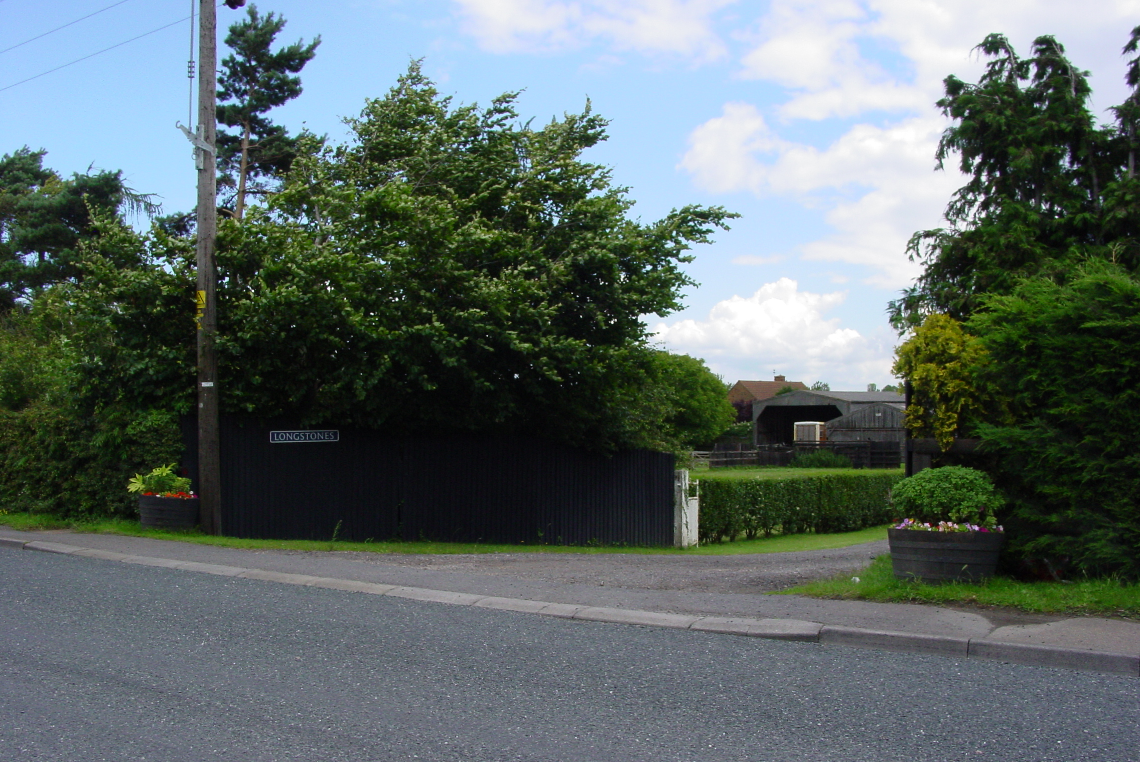
There was c. 100 a. of grassland in the 19th century, mainly bordering the river Kennett, with 3 a. at the southern end of the river's central loop known as horse pasture bottom. Longstones stud, based at Station Road, started in 1960, originally covered 155 a., and then around 125 a. c. 1984-97, with 25-30 mares.
Longstones Stud
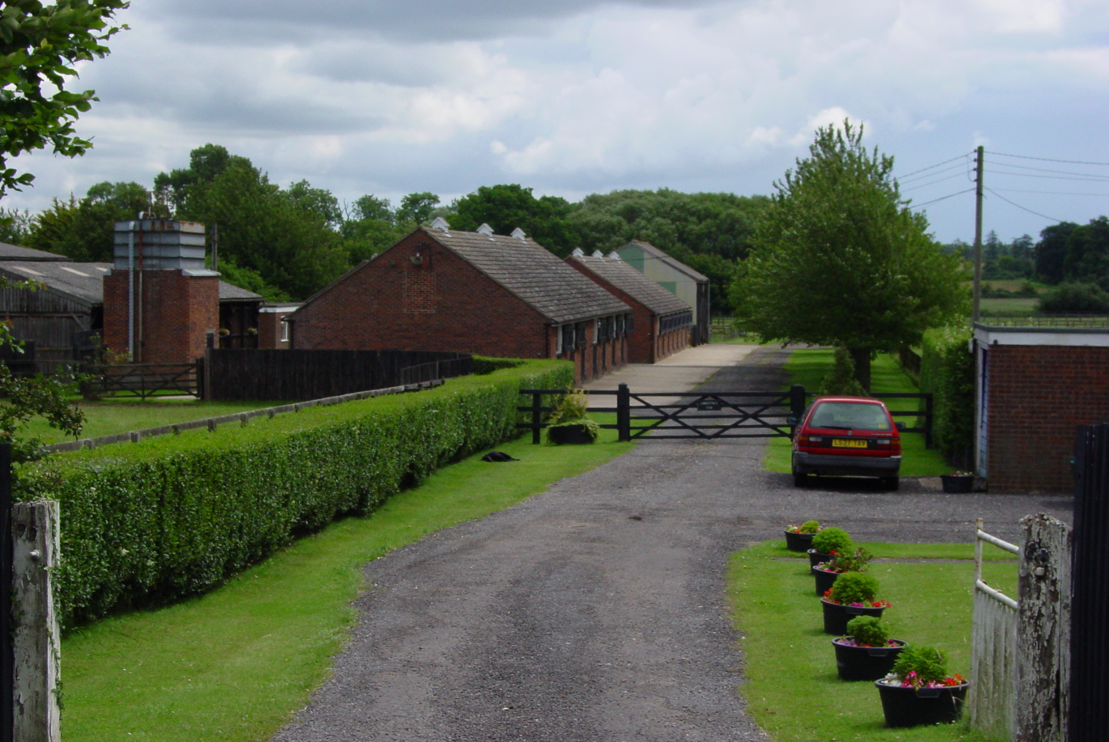
White House Stud opened in 1974 on 54 a. and increased its number of mares from 15 to 21 between 1980 and 1987. It was managed by Greville Starkey, but in the early 1990s it was sold. In 1984 St. Simon Stud was established on the former Rosemary farm, whose 300 a. of arable were laid down to pasture. In 1997 the stud had 54 mares.
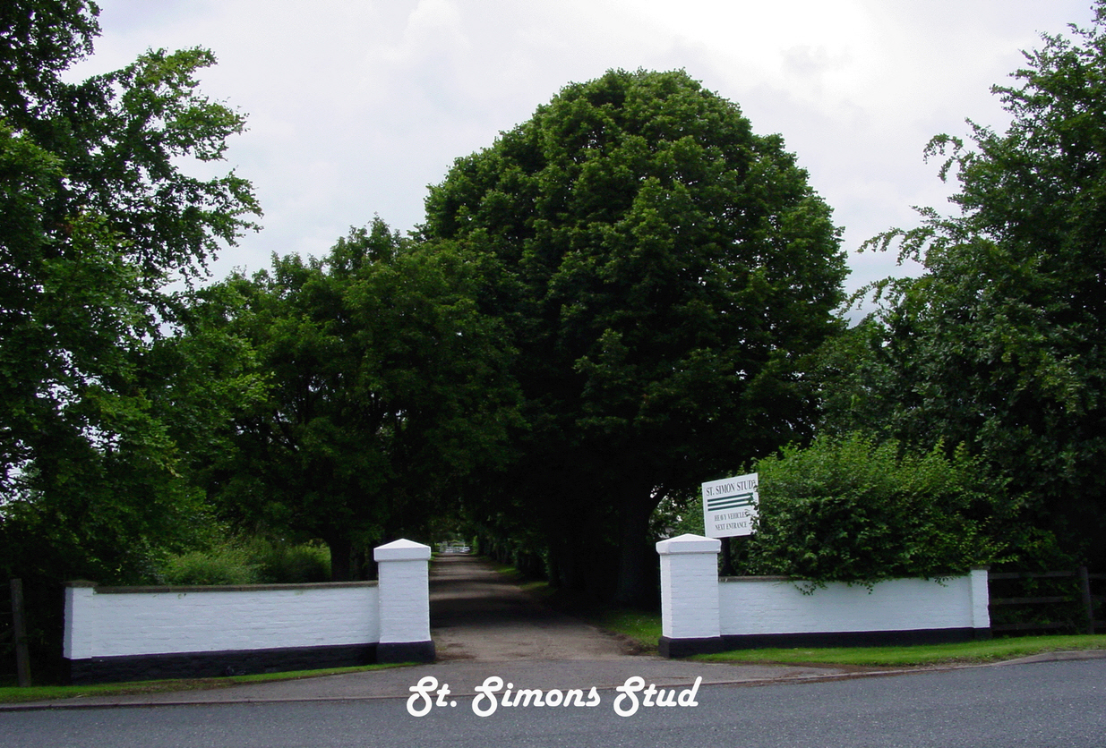 St. Simons Stud
Agriculture provided the main source of employment in the parish from the Middle Ages to the early 20th century. Of the parish's inhabitants 36 were farm labourers c. 1841-61, while c. 28-30 were so employed c. 1871-81. About 56 labourers were employed on the farms in the 1860s and 1870s, suggesting that some of the labour force came from neighbouring parishes. By 1930, however, only 17 people were employed as labourers, and by 1950 that figure had halved, falling further thereafter. In 1997 c. 10 people were employed in the parish in breeding and training horses.
There was a watermill at Kennett during the late 13th century. A saw mill, directly behind the Bell Inn on the south-west side of Station Road, was managed by successive owners of the inn from 1890 to 1929. It was then acquired by a building firm which specialized in the construction of stud farms, but in 1947 the site was taken over by the highway engineering business, MacLaren Brothers. The parish's gravel pits in its north-west corner were used in maintaining 80 km. of road for the county council, with 50 persons employed by the firm in 1961. It was still in business in 1998, but in new ownership. Associated Timber Services, established in Kennett in 1987, initially traded in trees blown down in the great storm. Timber purchased from Sandringham (Norf.) and large private estates was exported to Europe, but in 2000 the firm no longer operated out of Kennett.
During the Second World War 4 a. on the north-east side of Station Road was used by the Ministry of Food to store grain. Between 1946 and 1984 Mitchell and Butler's, brewers of Birmingham, used it to dry out and store barley. Banks Agriculture, which prepares cereals for use in breakfast cereals and sweets, employed around 8 persons from c. 1984.
Between 1841 and 1891 the parish had a cobbler, dressmaker, blacksmith and grocer. Until 1922 there was a blacksmith, and until 1937 one shop. There was a post office c. 1883, but villagers had later to rely upon the post office at Kentford. There used to be an asphalt plant at Station Road since 1979 but this has recently been demolished and as yet development of the land has yet to be decided.
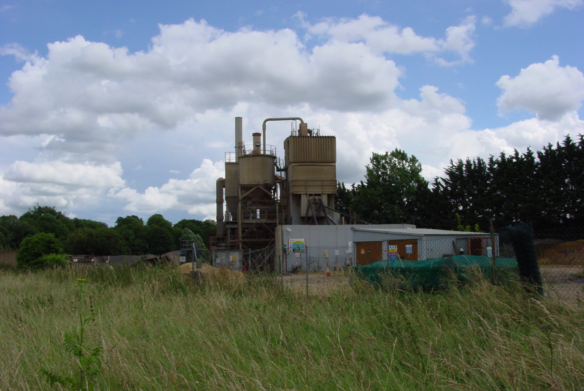 Picture of the old Hansons asphalt plant (now demolished)
In the late 20th century there were no shops or services in the parish, apart from the Bell Inn, but there was additional local employment during the 1980s and 1990s at Kennett Business Park, in the neighbouring parish of Moulton (Suff.), located on the southern side of the Newmarket-Bury road.
LOCAL GOVERNMENT.
In 1274 the lord of the manor had view of frankpledge, the assizes of bread and of ale, and free warren. Those rights continued to be exercised during the Middle Ages. There are no court rolls for the later Middle Ages, but court books survive almost continuously from 1652 until 1899. Although styled a view of frankpledge, the court mainly dealt with copyhold and freehold transactions. The amount spent by the parish on poor relief increased from £15 in 1775 to £35 in 1802, and then fourfold to £125 c. 1813-14. Expenditure remained stable until 1820, but then declined to c. £100 during the early 1830s. All relief at Kennett was out relief: in 1804 permanent out relief was given to only four adults, to three children, and to two old people. In 1813 ten persons were receiving out-relief permanently, and four others occasionally. Between 1776 and 1816 the amount spent on each poor person doubled, but expenditure in the parish was far beneath the average for Staploe hundred. From 1836 onwards Kennett was included in the Newmarket poor-law union. Kennett was part of Newmarket rural district during the early 20th century, but in the late 20th has been part of the Fenland villages district in East Cambridgeshire.