THIS WEBSITE IS NO LONGER IN USE. PLEASE CLICK THE FOLLOWING LINK TO GO TO THE CURRENT WEBSITE - https://kennett-pc.gov.uk/
Introduction to Kennett
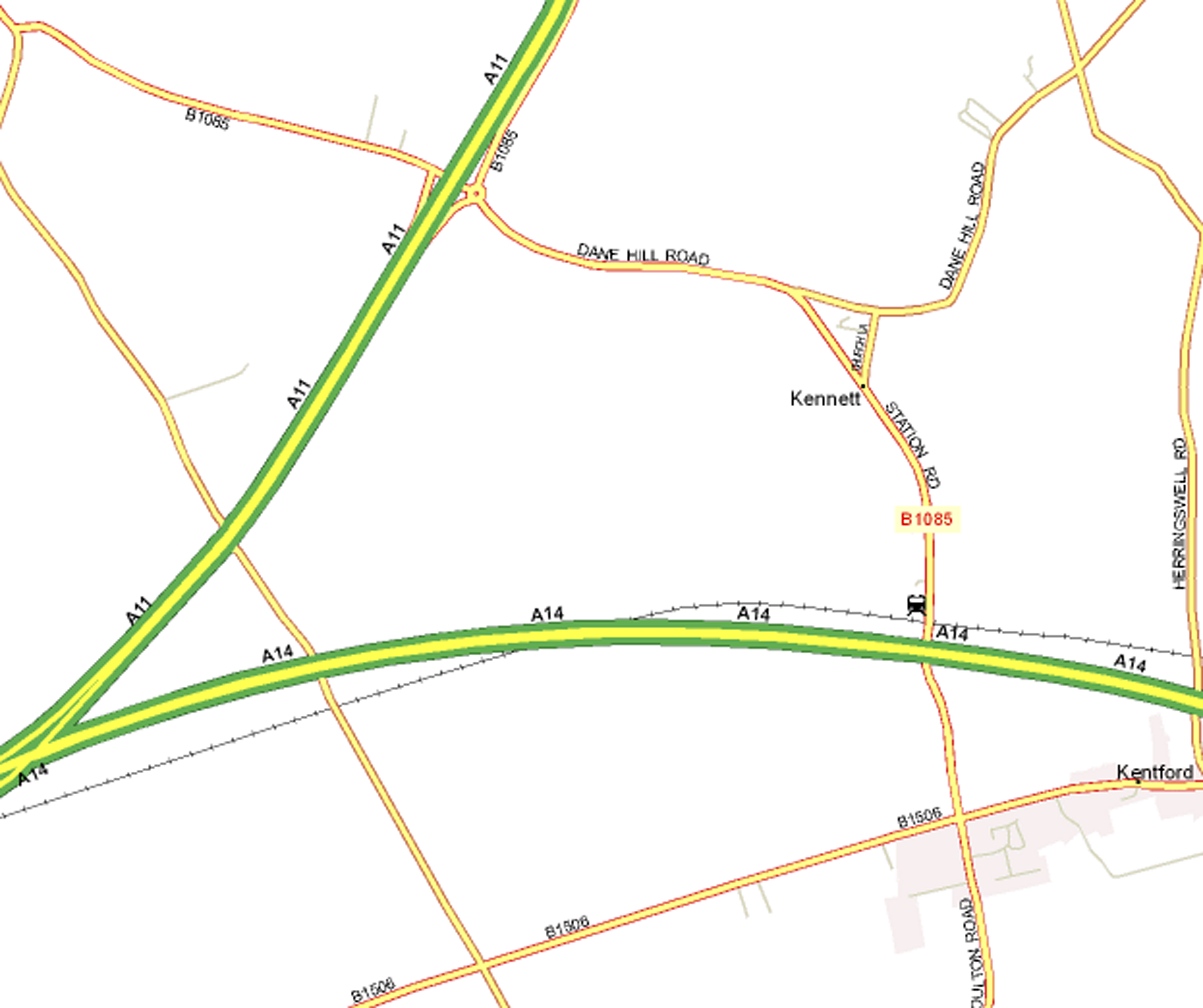
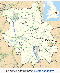
Welcome to Kennett, our small village and civil parish is at the very eastern tip of Cambridgeshire, England. We are situated around 2.5 miles ( 4.0 km) north-east of Newmarket and 13 miles(20 km) south-west of Bury St. Edmunds. We are situated within the district of East Cambridgeshire.We are a short distance from both the A11 and the A14.
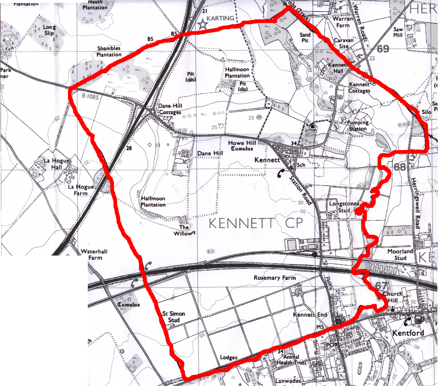
Kennett Parish Boundary Kennett Useful Facts
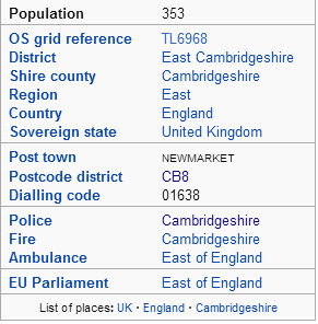
Kennett is lucky to have its own station with frequent trains to Cambridge, Ipswich and Peterborough. We have a population of approximately 320 people. We have our own village primary school, an ancient church (St. Nicholas) and a pub (The Bell) that can boast of 4 ghosts. We share our playing field, post office, garage, pavillion and village hall with our neighbouring Suffolk village of Kentford.
The parish is roughly square in shape, and borders Suffolk to its east and south. The eastern border is largely made up of the meandering medieval course of the River Kennett, though the river has been straightened in sections since the border was defined. The border deviates to the east of the river for a kilometre or so, such that the land around Kennett Hall falls into the parish. The straight southern border with Suffolk follows the ancient Icknield Way. The relatively straight west and north borders are former field boundaries that separate it from Chippenham.
The village is listed in the Doomsday Book of 1086 as Chenet,The village is named after the river Kennett, a tributary of the river Lark. T he river was forded at the south-east of the parish in around 1161 (from which the village of Kentford takes its name) and was navigable until at least the early 14th century, leading eventually to Kings Lynn. A 13th century ferry across the Kennett was known as Kentfayre, and the Newmarket to Bury St Edmunds road had a bridge over the river added in around 1600 on what became a busy Turnpike. Occasional flooding of the Kennett would damage the east of the parish, and a flood in 1968 destroyed the railway bridge at Kennett End. A pumping station was built just to the east of the church in 1977 to control flow.
The railway reached the parish in 1854 and Kennett railway station was opened at the south-east of the parish. It closed to goods trains in 1965 and became unstaffed after 1967, though trains between Cambridge and Ipswich still stop there, the only stop between Newmarket and Bury St Edmunds. The Newmarket by-pass opened in the early 1970s (now the A14 and runs alongside the railway at the south of the parish.
The village's population increased from 90 in the 1790s to a peak of 208 in 1851 before dropping to around 160 by the end of the 19th century. Increasing to around 200 between 1930 and 1950 it remained steady at about 270 between 1961 and 1991. In 2001 it stood at 364.
Kennett Hall, on the site which served as the manor house from the 12th century, was built in around 1870 by William Godfrey. The house has Neo-Palladian windows on the three-bayed south-west front. In 1958 it was divided into flats, and rented by members of the American armed forces.[2]
Chenet: St. Nicholas from William de Warenne. (Perhaps this is where Warren Road at Red Lodge gets its name from). (Information courtesy of Wikipedia)
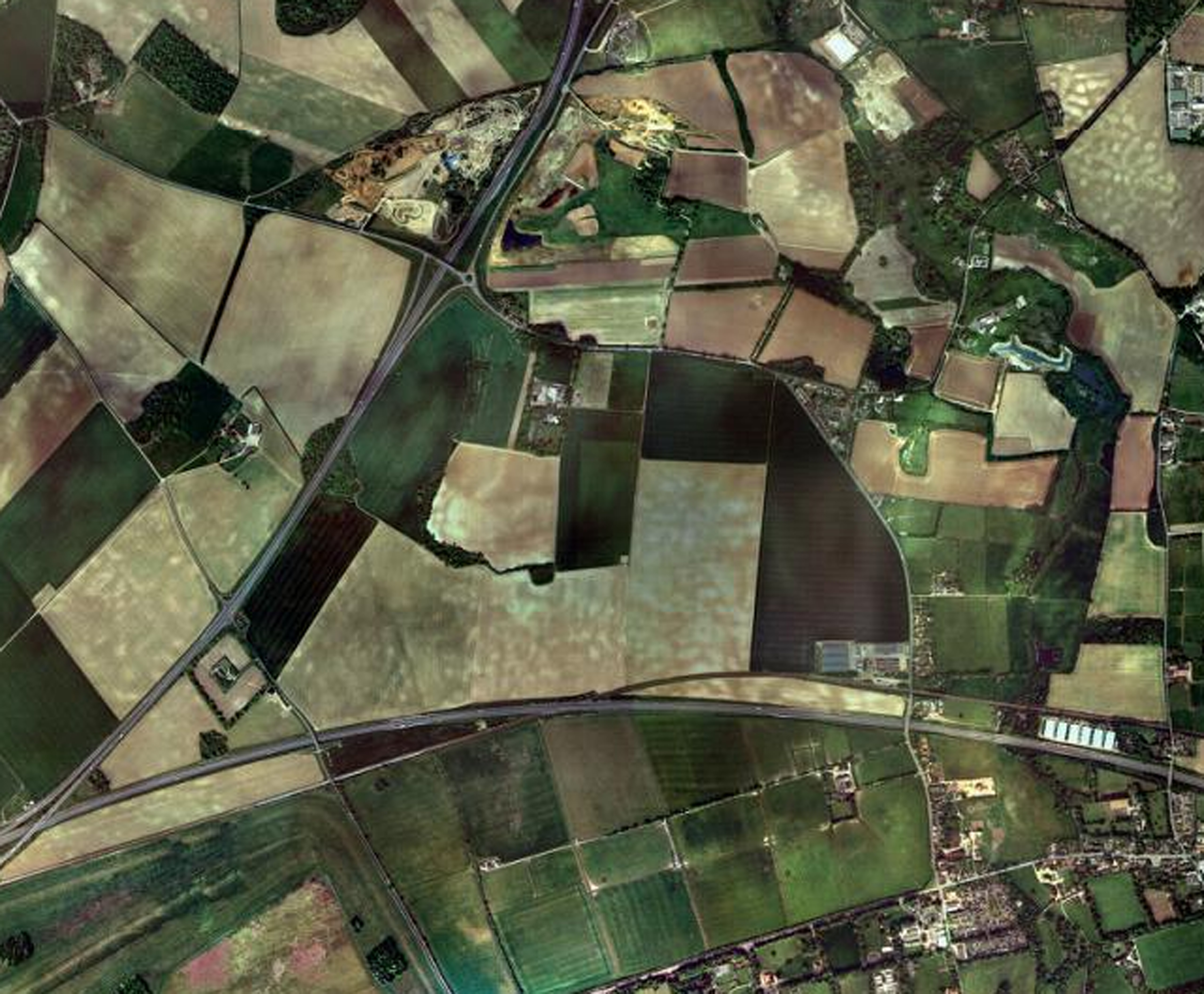
The following diagrams show:
a) Location of Kennett in Cambridgeshire b)An Aerial view of the parish ( Google maps)
c) The Parish Showing the road infrastructure